Saturday, August 22, 2009

Masters Research using Google

Why do I not own stock in Google? The bubble has not burst yet so it seems pretty solid; with GOOG-411, the forthcoming Google Voice, and Google Wave, etc. Let's go holidays!
Update: RIP Goog-411, hello Android voice-to-text

Speaking of celebration, I just finished my masters research. I was assisting with (and thanks to the shortcomings of ArcMap, I am continuing to finish) research at Florida State University which is continuing to investigate spatial patterns of cloud-to-ground lightning flashes across various landscapes. My contribution primarily aimed to build a geoprocessing model to assist with the preliminary data preparation for future iterations of similar research. Some other bricka-brack followed.

I decided to write it using Google Docs because I knew I would be working at home, in my office at DEP, and on campus and versioning is a pain in the ass. This is the 90's... nobody needs to save separate/new copies to a flash drive or send via e-mail anymore. This allowed me to edit a standard copy from various locations on demand. Very clean. Of course I formatted and submitted the final versions with Word (2003), though this MS Dependency is becoming increasingly antiquated with the assistance of LaTeX (a very good formating and publishing medium).

Although I didn't really need to use this feature, it is easy to set permissions and invite other users to view or edit any text document, spreadsheet, form, or presentation thuswise:


I strongly recommend reading the Survey of Literature / Background and ignoring the rest of it. It "briefly" introduces what a thunderstorm is and how they are created.

There are around 40 references in total (each document basically composes the final report) - to which I would like to give many thanks to Google Scholar and Google Books.

Scholar is aided by a proxy connection to FSU's library which has subscriptions to many of the journals that are returned in a search. Books doesn't have every book, nor does it allow users to see every page of all available books, however I was able to serach thousands of books for a single word or phrase, and the results are not only higlighted, but each page is presented with separate previews and links to the specific page of the book.

I can't imagine a world (I'm looking at you, the 20th centrury) that did not have the luxary of these efficient tools. Walking to the library and reading through hundreds of pages of books and journals absolutely has its benefits (learning vast amounts of supplementary information and providing a more comprehensive overview of the topics of interest), but it's for suckas.

Tips for Digital Audio Recording & Increasing Computer Speed

My computer is a few years old now (got Lappy Tappy for Hanukkah, 2005), and it's filled to the brim with all sorts of (mostly) high end software for spatial modeling & image processing (ArcMap, Erdas Imagine, IDRISI Andes, R, NetLogo, and some GPS utilities) and music production (Cubase, Fruity Loops, Ableton Live, Reason, Audacity, Guitar Pro, NoteWorthy Composer, and some other mixer and MIDI interface tools).

Wow, didn't realize how bad it really was. It takes forever (a good five minutes) to load Mozilla - which encompasses 90% of my workload on here. It seems silly to bog it down with all that software. Rock Machine is significantly more powerful, however I rarely use it because it's in the recording cart (still upcoming post) and it's just easier to use Lappy Tappy for every day communication in front of the tele.

Anyway, I came across some tips for speeding up a computer. Enjoy.

Tips and tricks for music and computers
Optimizing Your Computer Recording System
http://alesis.com/tipsnov08


A few good starting points of my own:
  • Clear off the desktop. Put all of those random folders, mp3's, images, shortcuts, etc. in My Documents or somewhere else. Consolidate into a single "Desktop Junk" folder.
  • Empty your recycling bin
  • Clear out C:\temp
  • Clear internet browser history, temporary internet files, cookies, etc.
  • Remove programs from Start :: Programs :: Startup
  • Disable startup programs
    • Go to Start :: Run
    • Type msconfig and hit OK
    • In the Services tab, check 'Hide All Microsoft Services' and then uncheck anything that looks unnecessary (i.e. Google / iPod updates, etc)
    • In the Startup tab, uncheck anything that seems unnecessary. Expand the Command field to look for updates, media launchers, peripheral (printers, cameras, etc) management, etc. Use a search engine to investigate unknown items
    • Hit OK and restart the computer
  • Run a Virus Scan (AVG is free and light)
  • Run Ad-Aware free adware removal software
  • Run Malwarebytes free malware removal software
  • Move Pictures, videos, music, homework, old files, etc. to a portable hard drive (I suggest a hard drive that is powered by USB and does not need to plug into the wall, for instance the Western Digital Passport)
  • Uninstall uselesss/unused programs or games from Control Panel :: Add or Remove Programs. Often you can save data or save files and remove the game that isn't played
  • Clean your registry. There are a few good utilities out there to do this. If you don't know what it is then don't bother, so I won't post links.
  • Finally, defrag your hard drive overnight and restart in the morning
  • I've never used it, but it would be wise to set a system restore point (Start :: Programs :: Accessories :: System Tools :: Backup)

Monday, August 17, 2009

Using High Resolution Satellite Imagery to Map Black Mangrove on the Texas Gulf Coast


Presented 3 February 2009
Spring 2009 Advanced Remote Sensing
Florida State University

Reviewing the work of Everitt, J.H., Yang, C., Sriharan, S., and Judd, F.W. 2008 Using High Resolution Satellite Imagery to Map Black Mangrove on the Texas Gulf Coast. Journal of Coastal Research, 24:6, 1582-1586


This is the (very abbreviated) presentation I gave summarizing the article above. My presentations usually go into illustrative detail about each point, so the information in the Power Point document itself is not as informative. The presentation discusses a brief introduction on the species, their location and salt-tolerant characteristics, importance of mangroves habitat, etc. followed by more technical information regarding remote sensing techniques, methodology and sampling design, accuracy assesment and field verification, and finally a brief discussion (mostly omitted from the presentation) regarding analysis of the results of the study.


Wednesday, August 12, 2009

When in doubt using Visual Basic, hit Ctrl+T: A short guide to adding controls

I am used to programming with the Visual Basic Editor in ArcMap, Excel, and Access. I'm building a weather client (upcoming article) that will be a one stop resource for various weather maps, models, and surf reports from around the Internets that I use to help predict my next surfing or diving trip. The best way to manage all of these maps and graphics that I can think of right now is to use a multi page control to separate the various groups into individual tabs.

This is easy enough in ArcMap - the MultiPage control is already loaded onto the main toolbar (left). Visual Basic is a bit more tricky however.

Many extra options and controls (including a previous post about the Common Dialog) are not automatically loaded onto the Visual Basic 6 general Toolbox by default. By right clicking in some empty gray space away from a tool, or by pressing Ctrl+T, one can launch the Components window. From here, a number of additional controls can be added to the toolbox to be inserted into a form or project. In teh following case, the Microsoft Tabbed Dialog Control 6.0 is checked. A TabStrip can also be added through the Microsoft Windows Common Controls - I used 6.0 (SP6) which is a few below the Tabbed Dialog Control.


A multi page tab system can be inserted to to organize the data inside of this new form:


This is the VB 6 toolbox from which the new control can be called:


If there seems to be something missing from a Visual Basic toolbox, hit Ctrl+T and skim through the available controls - it will probably be located in there.

Wednesday, August 5, 2009

ArcMap Win: Access Data View Elements from the Print Layout View

When in the ArcGIS layout view, double click on the data frame to access annotation, graphics, or any other cartographic elements that are located in Data View. Elements found only in layout view (legend, north arrow, scale bar, text, etc.) will not be selected when accessing the data view from layout view. It's a quick way to manipulate the map design without having to fully switch between the two views or without having to redraw the map.

When you double click on the data frame a small, hashed border will appear around the frame's neatline signifying that only the elements within the data frame are being accessed.

This is great for placing manual text annotation within the map itself, rather than just adding various extra text elements to layout view. By placing them into the map it is possible to pan around while keeping the label in reference with the geography of the area of interest.

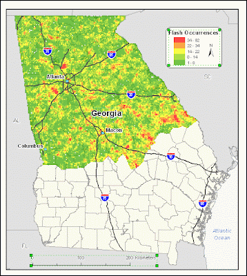
Here the legend graphics, scale bar, and the text element of Georgia are selected in layout view:


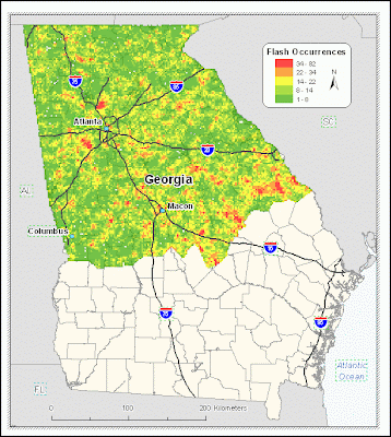
Now when attempting to select all elements (via the Select Elements tool, or by Edit :: Select All Elements), only those elements included in Data View are selected. In this case, all city and state labels, and interstate markers were converted to annotation: